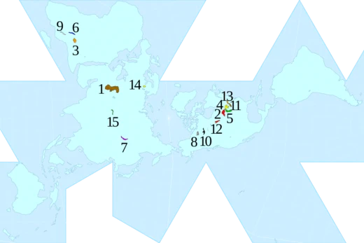
Lake Maracaibo
Large Venezuelan water body, possibly an estuary, rich in oil.

Wilfredor · CC BY-SA 3.0
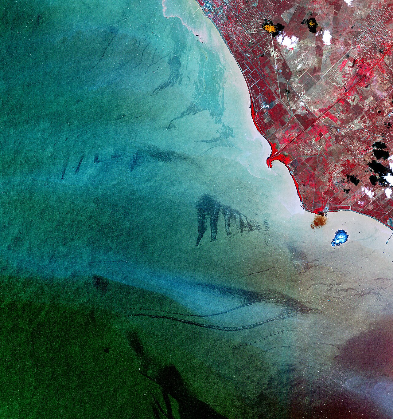
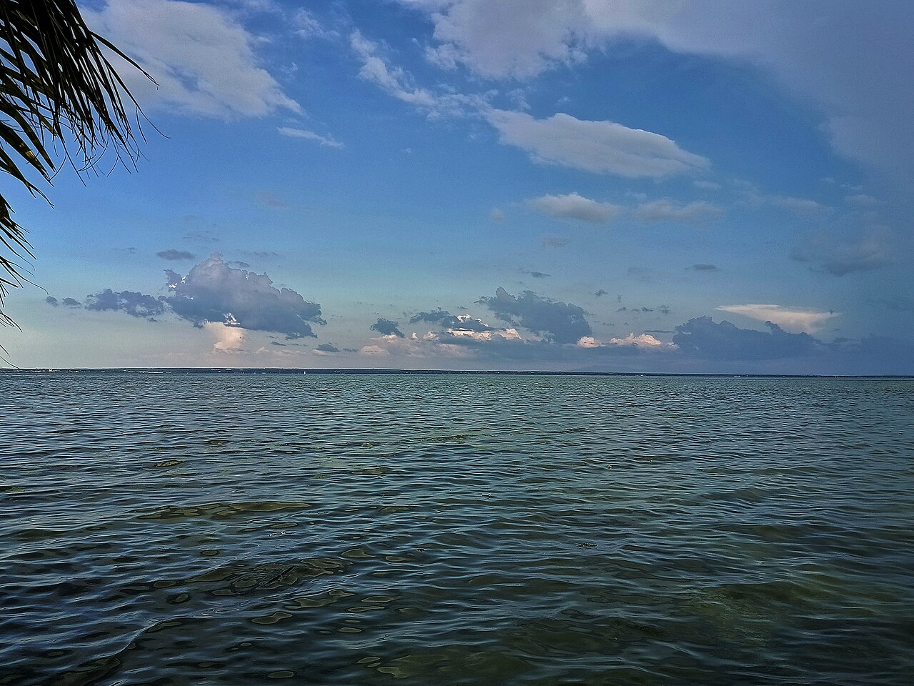
Lake Maracaibo is a large body of water in northwestern Venezuela, located between the states of Zulia, Trujillo, and Mérida. Though commonly called a lake, its current hydrological characteristics may better classify it as an estuary or semi-enclosed bay connected to the Gulf of Venezuela. With a surface area of 13,512 km², if counted as a lake it would be the largest in South America, ahead of Lake Titicaca, and is one of the oldest lakes on Earth, having formed 36 million years ago in the Andes Mountains. The lake consists of brackish water and is connected to the Gulf of Venezuela to the north by a narrow strait. It is fed by numerous rivers, the biggest being the Catatumbo River.
- age
- 36 million years (late Eocene)
Verified Timeline
Lore & Background
Lake Maracaibo is located within the eponymous basin and is one of the oldest lakes on earth. It was formed 36 million years ago when the faults collapsed when the Andes were uplifted in the late Eocene. In the geological history, sea water and fresh water have alternated many times. At the end of the last glacial period, the sea level rose, connecting Lake Maracaibo directly with the Atlantic Ocean, and the lighter fresh water floated on the heavier salt water, causing nutrients to be deposited on the bottom, resulting in a more than five-kilometre thick deposit of sediment on the bedrock. In the Pliocene, the depression reached what would be practically its current form. The lake is vase-shaped, 210 km long from north to south, 121 km wide from east to west, covers 13,512 km², the deepest is 35 m, the shore length is about 1,000 km, and the volume is about 280 km³. The largest river entering the lake, the Catatumbo River, provides 57% of the water entering the lake. The lake water circulates counterclockwise due to prevailing winds. The northern half is a bottleneck 55 km long. The southern part is lighter due to river water injection, while the northern part is slightly salty due to tidal influence. The Catatumbo River forms a bird-foot-shaped delta in the southwest, where surface salinity is only 0.13%, but bottom salinity reaches 0.2–0.3% due to seawater intrusion. The north is connected with the Gulf of Venezuela, and the spit at the mouth extends for about 26 km.
Reader's Guide
Lake Maracaibo is Venezuela's main oil producing area. The Maracaibo oil field was discovered in 1914, the first oil well was constructed in 1917, and large-scale exploitation began in 1922. Oil fields are concentrated in the northeast and northwest of the lake, with a hydrocarbon-bearing area of 1,300 km². The lake is also an important fishing and agricultural area, supporting more than 20,000 fishermen. The area around the lake is inhabited by a quarter of Venezuela's population. The lake is famous for Catatumbo lightning, the most frequent lightning on Earth, with about 233 lightning strikes per square kilometer per year, occurring on average about 297 days per year. At its peak in September, the lake area can experience up to 280 lightning strikes per hour, approximately 28 lightning strikes per minute, lasting up to nine hours. Eutrophication caused by oil pollution is a major environmental problem. The lake is home to endangered aquatic mammals including the West Indian manatee and the Amazon river dolphin, and about 145 species of fish, many endemic such as the Maracaibo half-hooked catfish, Maracaibo hairy catfish, Maracaibo Lake Lamont catfish, Lake Maracaibo tetra, and Maracaibo wolf anchovies. The General Rafael Urdaneta Bridge over the lake connecting Maracaibo and Santa Rita was completed in 1962.
Did You Know?
- Lake Maracaibo formed 36 million years ago when faults collapsed during the uplift of the Andes in the late Eocene.
- The Catatumbo River provides 57% of the water entering the lake.
- Catatumbo lightning occurs on average 297 days per year, with about 233 lightning strikes per square kilometer annually.
- The lake's northern half became brackish after dredging in the 1930s and a breakwater completed in 1957 allowed ocean-going tankers to enter.
- The lake is home to two endangered aquatic mammals: the West Indian manatee and the Amazon river dolphin.
Geological Origins & Physical Character
Born roughly thirty-six million years ago during the late Eocene, Lake Maracaibo owes its existence to the dramatic uplift of the Andes, which triggered the collapse of ancient fault lines and carved out the basin nestled between the Perija and Merida ranges. Over millions of successive cycles, seawater and freshwater repeatedly flooded and receded from this depression, and by the Pliocene the water body had settled into a shape closely resembling its present form. The end of the last glacial period brought a transformative event: rising sea levels linked the basin directly to the Atlantic, and lighter fresh water floated atop denser salt water, driving nutrient-rich sediments to the bottom and accumulating a layer exceeding five kilometres over the bedrock.
Today the lake displays a vase-like silhouette, stretching 210 kilometres north to south and 121 kilometres at its widest point. Its surface spans 13,512 square kilometres, its shoreline winds for roughly 1,000 kilometres, and its volume reaches about 280 cubic kilometres. The southern half plunges to 35 metres while the northern bottleneck stays shallow. Water circulates counterclockwise under prevailing winds, and the Catatumbo River delivers 57 percent of all inflow, with roughly fifty other rivers feeding the system.
The Catatumbo Lightning & Climate
The southern reaches of Lake Maracaibo host one of the most extraordinary meteorological phenomena on the planet. When cool mountain winds descending from the Andes at night collide with the warm, humid air hovering over the lake surface, they generate a near-continuous cycle of almost silent lightning discharges known as Catatumbo lightning. The result is a region that records the highest lightning frequency anywhere on Earth, averaging 233 strikes per square kilometre each year. Nocturnal thunderstorms break over the water on roughly 297 days annually, and the annual average temperature hovers around 28 degrees Celsius.
The phenomenon reaches its most spectacular expression in September, when the lake area can endure up to 280 strikes per hour—nearly 28 per minute—sustained for as long as nine hours at a stretch. The brilliant flashes have long served as a natural beacon for sailors navigating the waterways after dark. Rainfall patterns across the basin are uneven: the southern shore receives an average of 1,400 millimetres of precipitation per year, while the northern half stays drier. The mountain-wind interaction also contributes an additional 297 millimetres of annual rainfall over the lake itself.
Human History & the Naming of Venezuela
Long before European eyes ever reached its shores, the Añú people built stilt-house communities along the lake's banks, calling the water Coquivacoa. Neighbouring Wayuu, Caquetíos, and Quiriquires tribes also made the region home. On August 24, 1499, the fleet of Italian navigator Amerigo Vespucci and Spanish explorer Alonso de Ojeda became the first Europeans to enter the area. Struck by the resemblance between the Añú stilt dwellings and the canals of Venice, Vespucci dubbed the region Veneziola—a name that evolved into Venezuela, or "Little Venice."
Spain attempted to found permanent settlements around the lake in 1529 and again in 1569, but it was not until 1574 that the city of Maracaibo was successfully established. The waterway's strategic importance drew conflict for centuries: in the spring of 1669, the privateer Henry Morgan raided lakeside settlements and routed a Spanish squadron dispatched to stop him. A far more consequential engagement came on July 24, 1823, when Venezuelan forces won the decisive Battle of Lake Maracaibo during the War of Independence, securing the nation's sovereignty over the region.
Industry, Infrastructure & Environmental Pressure
Often called the "oil lake," Lake Maracaibo sits atop one of Venezuela's richest deposits of petroleum and natural gas, making it the country's principal hydrocarbon-producing region. The collapsed fault in the northern section of the basin underlies these vast subsurface resources. Beyond energy, the surrounding area supports critical fishing and agricultural activity, and roughly a quarter of Venezuela's entire population calls the lakeshore home.
Twentieth-century engineering reshaped the waterway's character. In the 1930s, dredging deepened the lake mouth from about four metres to eight, and the completion of a stone breakwater in 1957 raised the channel to eleven metres, finally permitting ocean-going tankers to navigate into the basin. This same intervention transformed the northern waters from fresh to brackish. In 1962, the 8,678-metre General Rafael Urdaneta Bridge spanned the lake, linking the cities of Maracaibo and Santa Rita.
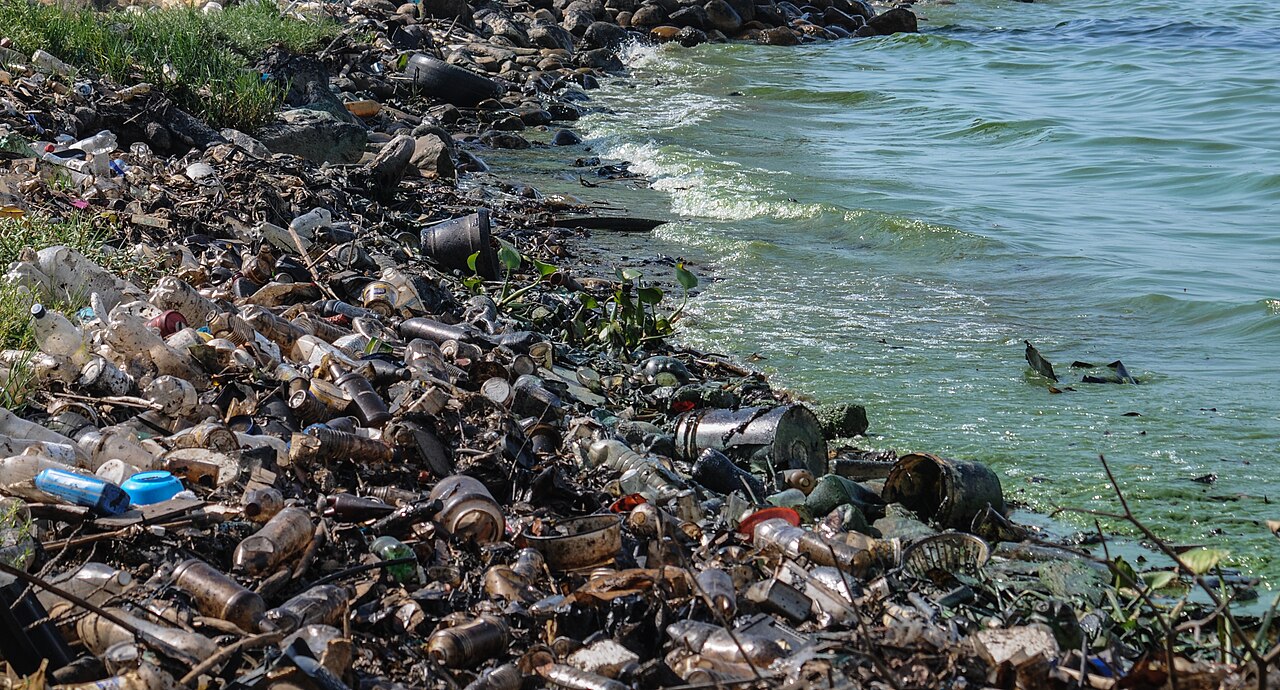
Yet the very industry that sustains the region has generated a serious ecological crisis: oil pollution has driven severe eutrophication, degrading water quality and threatening the fisheries and agriculture on which so many depend.
Gallery
Frequently Asked Questions
What is Lake Maracaibo?
Lake Maracaibo is a large body of water in northwestern Venezuela, bordered by the states of Zulia, Trujillo, and Mérida. It sits at the junction where the Gulf of Venezuela meets the Orinoco River system.
Is Lake Maracaibo technically a lake?
Its classification is debated; many hydrologists argue it functions more as a semi-enclosed estuary because of its open connection to the Gulf of Venezuela. The 'lake' label persists in common usage and geography texts despite this ambiguity.
How old is Lake Maracaibo?
Geological evidence places the formation of its basin somewhere in the Miocene to Pliocene epochs, giving it an estimated age of roughly five to twenty-three million years.
Why do some sources call Lake Maracaibo the largest lake in South America?
If it is counted as a lake rather than an estuary, its surface area exceeds that of Lake Titicaca, the next-largest candidate on the continent. The ranking hinges entirely on whether the estuary classification is accepted.
What makes Lake Maracaibo geographically and economically significant?
The surrounding region is rich in petroleum deposits, making it a major area for oil extraction in Venezuela. It also serves as a natural harbor and a key geographic crossroads in the country's northwest.
More in Lakes Of The World 1-18
Spotted an error? Know more?
This is a living reference — every entry is fact-audited, and reader corrections feed straight into our audit queue. Suggest an edit · See this site's audit record