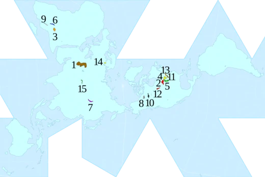
Lake Ontario
Easternmost Great Lake, outlet to the Atlantic via the Saint Lawrence.

Dougtone · CC BY-SA 2.0
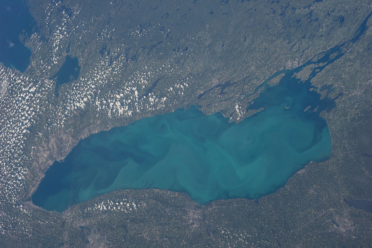
Lake Ontario is one of the five Great Lakes of North America. It is bounded on the north, west, and southwest by the Canadian province of Ontario, and on the south and east by the U.S. state of New York. The Canada–United States border spans the centre of the lake. On the Canadian side, the major cities are Kingston, Mississauga, Toronto, Hamilton, and St. Catharines. On the American side, the major cities are Rochester and Watertown. The last in the Great Lakes chain, Lake Ontario serves as the outlet to the Atlantic Ocean via the Saint Lawrence River, comprising the western end of the Saint Lawrence Seaway. Its primary inlet is the Niagara River from Lake Erie. The Long Sault control dam, primarily along with the Moses-Saunders Power Dam regulates the water level of the lake. The name Ontarí'io is most often translated from Wyandot as 'beautiful lake', but other translations exist.
- surface_area
- 7,340 square miles (19,011 km²)
- volume
- 393 cubic miles (1,640 km³)
- maximum_depth
- 802 feet (244 m) in the Rochester Basin
- average_depth
- 283 feet (86 m)
- maximum_length
- 193 statute miles (311 km)
- maximum_width
- 53 statute miles (85 km)
- shoreline_length
- 712 miles (1,146 km) including islands
Verified Timeline
Lore & Background
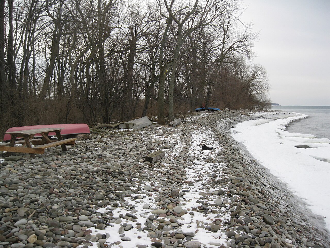
Lake Ontario is the easternmost of the Great Lakes and the smallest in surface area (7,340 square miles), although it exceeds Lake Erie in volume (393 mi³ to 116 cu mi). It is the 13th-largest lake in the world. When its islands are included, the lake's shoreline is 712 miles long. As the last lake in the Great Lakes' hydrologic chain, Lake Ontario has the lowest mean surface elevation of the lakes at 243 feet above sea level; 326 feet lower than its neighbor upstream. Its maximum length is 193 statute miles, and its maximum width is 53 statute miles. The lake's average depth is 47 fathoms 1 foot (283 ft), with a maximum depth of 133 fathoms 4 feet (802 ft) in the Rochester Basin. The lake's primary source is the Niagara River, draining Lake Erie, with the Saint Lawrence River serving as the outlet. The drainage basin covers 24,720 square miles. As with all the Great Lakes, water levels change both within the year and among years. These water level fluctuations are an integral part of lake ecology and produce and maintain extensive wetlands. The lake also has an important freshwater fishery, although it has been negatively affected by factors including overfishing, water pollution and invasive species. The lake basin was carved out of soft, weak Silurian-age rocks by the Wisconsin ice sheet during the last ice age. The action of the ice occurred along the pre-glacial Ontarian River valley. As the ice sheet retreated toward the north, it still dammed the St. Lawrence Valley outlet, so the lake surface was at a higher level. This stage is known as Lake Iroquois. When the ice finally receded from the St. Lawrence valley, the outlet was below sea level, and for a short time, the lake became a bay of the Atlantic Ocean, in association with the Champlain Sea. Gradually the land rebounded from the release of the weight of about 6,500 feet of ice. It is still rebounding about 12 inches per century in the St. Lawrence area. This means the lake bed is gradually tilting southward, inundating the south shore and turning river valleys into bays. The lake has a natural seiche rhythm of eleven minutes. Because of its great depth, the lake as a whole does not completely freeze in winter, but an ice sheet covering between 10% and 90% of the lake area typically develops. The lake has completely frozen over on five recorded occasions: in 1830, 1874, 1893, 1912, and 1934. When the cold winds of winter pass over the warmer water of the lake, they pick up moisture and drop it as lake-effect snow. Since the prevailing winter winds are from the northwest, the southern and southeastern shoreline of the lake is referred to as the snowbelt. In some winters, the area between Oswego and Pulaski may receive twenty or more feet of snowfall. Also impacted by lake-effect snow is the Tug Hill Plateau, an area of elevated land about 20 miles east of Lake Ontario. The 'Hill' typically receives more snow than any other region in the eastern United States.
Reader's Guide
Lake Ontario is the last lake in the Great Lakes' hydrologic chain, serving as the outlet to the Atlantic Ocean via the Saint Lawrence River, comprising the western end of the Saint Lawrence Seaway. Its primary inlet is the Niagara River from Lake Erie. The Long Sault control dam, primarily along with the Moses-Saunders Power Dam regulates the water level of the lake. Baymouth bars built by prevailing winds and currents have created a significant number of lagoons and sheltered harbors, mostly near (but not limited to) Prince Edward County, Ontario, and the easternmost shores. Perhaps the best-known example is Toronto Bay, chosen as the site of the Upper Canada capital for its strategic harbor. Other prominent examples include Hamilton Harbour, Irondequoit Bay, Presqu'ile Bay, and Sodus Bay. The bars themselves are the sites of long beaches, such as Sandbanks Provincial Park and Sandy Island Beach State Park. These sand bars are often associated with large wetlands, which support large numbers of plant and animal species, as well as providing important rest areas for migratory birds. Presqu'ile, on the north shore of Lake Ontario, is particularly significant in this regard. One unique feature of the lake is the Z-shaped Bay of Quinte which separates Prince Edward County from the Ontario mainland, save for a 2-mile isthmus near Trenton; this feature also supports many wetlands and aquatic plants, as well as associated fisheries. Major rivers draining into Lake Ontario include the Niagara River, Don River, Humber River, Rouge River, Trent River, Cataraqui River, Genesee River, Oswego River, Black River, Little Salmon River, Credit River, Ganaraska River and the Salmon River. The Welland Canal also drains into the lake. The Great Lakes watershed is a region of high biodiversity, and Lake Ontario is important for its diversity of birds, fish, reptiles, amphibians, and plants. Many of these special species are associated with shorelines, particularly sand dunes, lagoons, and wetlands. The importance of wetlands to the lake has been appreciated, and many of the larger wetlands have protected status. These wetlands are changing, partly because the natural water level fluctuations have been reduced. Many wetland plants are dependent upon low water levels to reproduce. When water levels are stabilized, the area and diversity of the marsh is reduced. This is particularly true of meadow marsh; for example, in Eel Bay near Alexandria Bay, regulation of lake levels has resulted in large losses of wet meadow. Often this is accompanied by the invasion of cattails, which displace many of the native plant species and reduce plant diversity. Eutrophication may accelerate this process by providing nitrogen and phosphorus for the more rapid growth of competitively dominant plants. Similar effects are occurring on the north shore, in wetlands such as Presqu'ile, which have interdunal wetlands called pannes, with high plant diversity and many unusual plant species. Most of the forests around the lake are deciduous forests dominated by trees including maple, oak, beech, ash and basswood. These are classified as part of the Mixedwood P
Did You Know?
- Lake Ontario is the 13th-largest lake in the world.
- The lake has a natural seiche rhythm of eleven minutes.
- Lake Ontario has completely frozen over on five recorded occasions: 1830, 1874, 1893, 1912, and 1934.
- The name Ontarí'io is most often translated from Wyandot as 'beautiful lake'.
- The land around the St. Lawrence area is still rebounding about 12 inches per century from the weight of ice that was stacked on it.
The Unmatched Density of Water
Ontario, the province, is a landscape so saturated with standing water that it holds more than a quarter of a million distinct lakes. That figure of 250,000 is not a rounding or an estimate from a single survey; it is the working count that frames every discussion of the province's hydrology. What makes the number genuinely staggering is that it includes the Great Lakes themselves, meaning the vast, internationally shared water bodies sit on the same ledger as a tiny unnamed basin in a remote district. The sheer density means that water is not merely a feature of Ontario's terrain so much as its defining substrate. The count stretches across every district and region, from the Kenora and Algoma areas to the Muskoka and Haliburton zones, and it is a number that no single map can adequately capture. Ontario's identity, in the most literal geographical sense, is inseparable from its lakes.
A Binational Water Reserve
The Great Lakes, which form part of Ontario's 250,000-lake inventory, constitute a binational system shared between Canada and the United States. Together they hold roughly twenty percent of the world's fresh surface water, a proportion that places them among the most consequential freshwater reservoirs on Earth. It is important to note, however, that this twenty-percent figure reflects the combined volume of the Great Lakes as a single system, not the aggregate of the many smaller lakes scattered across the province. The distinction matters: the Great Lakes are a handful of enormous basins whose collective depth and surface area dwarf the tens of thousands of smaller lakes that make up the rest of Ontario's count. The binational character of the system means that water governance, ecological health, and resource management are shared responsibilities, linking the fate of Ontario's largest water bodies to those on the American side of the border.
A Naming Tapestry
The alphabetical sweep from 24 Mile Lake to Zionz Lake reveals a naming landscape of extraordinary variety. Descriptive English names abound: Onion Lake, Otter Tail Lake, Rainbow Lake, Red Cedar Lake, Red Squirrel Lake, and Skeleton Lake each paint an immediate visual. French-language entries weave through the list—Lac Orignal, Lac Paradis, Lac Pivabiska, Lac à la Plonge, Lac du Rocher-Fendu, Lac Ste.-Thérèse, Lac St. Jean, and Lac de Zajac—testifying to the province's bilingual heritage. Numerical designations like Lake 226, Lake 227, Lake One, Six Mile Lake, and Lake Twentythree suggest a surveyor's shorthand that never was replaced. Indigenous and First Nations names such as Wabatongushi, Wabigoon, Wapikopa, Ozhiski, and Onigam carry their own histories. And duplication is common: Sandy Lake, Riley Lake, Trout Lake, and Seymour Lake each appear more than once, reminding us that in a province with a quarter-million lakes, no name is truly unique.
The Threshold and the Incomplete Record
The list from which these lakes are drawn is explicitly incomplete, a caveat that underscores how vast the true inventory remains. The subset presented here focuses on lakes exceeding 400 square kilometres—roughly 150 square miles—which is a deliberately high threshold that captures only a small fraction of Ontario's total. Even within that filtered group, the alphabetical run stretches from 24 Mile Lake at the top through the O, P, R, S, T, U, V, W, Y, and Z entries, and it still omits countless smaller basins that fall below the cutoff. The list draws on references and external links to the Geographical Names, Canada database, anchoring it in an official nomenclature system. Yet the very existence of an incomplete qualifier, alongside the sheer number of entries, conveys a simple truth: any enumeration of Ontario's lakes is, by necessity, a partial portrait. The province's waterways exceed the capacity of any single catalogue.
Gallery
Frequently Asked Questions
Who is Lake Ontario?
Lake Ontario is the easternmost and smallest-by-surface-area member of the five Great Lakes, nestled between the Canadian province of Ontario and the U.S. state of New York. Despite covering only about 7,340 square miles, it actually holds more water than its sibling Lake Erie.
What is Lake Ontario's role in the Great Lakes system?
It serves as the final Great Lake before water reaches the sea, funneling the combined outflow of all five lakes into the Saint Lawrence River and onward to the Atlantic Ocean. This makes it the essential drainage gateway for the entire Great Lakes basin.
How does Lake Ontario's story end?
Rather than ending in isolation, its waters flow eastward through the Saint Lawrence River, eventually emptying into the Gulf of St. Lawrence and the open Atlantic. In fan-encyclopedia terms, it is the 'exit stage' of the Great Lakes saga.
Why is Lake Ontario important?
It anchors major metropolitan areas on both shores—Toronto to the north and Buffalo to the south—and hosts the Saint Lawrence Seaway, a critical shipping corridor linking inland ports to the ocean. Its maximum depth of roughly 802 feet in the Rochester Basin also gives it a surprisingly deep profile for its modest surface size.
How does Lake Ontario compare in size to its sibling lakes?
At about 193 miles long and 53 miles wide, it is the smallest Great Lake by surface area, yet its 393 cubic miles of volume actually exceeds Lake Erie's. With an average depth near 283 feet, it packs a notably compact but deep shape.
More in Lakes Of The World 1-18
Spotted an error? Know more?
This is a living reference — every entry is fact-audited, and reader corrections feed straight into our audit queue. Suggest an edit · See this site's audit record