Lake Michigan
The only Great Lake wholly within the United States.

Michael Barera · CC BY-SA 4.0
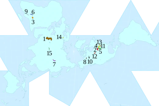
Lake Michigan is one of the five Great Lakes of North America. It is the second-largest of the Great Lakes by volume (1,180 cu mi; 4,900 km³) and depth (923 ft; 281 m) after Lake Superior and the third-largest by surface area (22,300 square miles; 57,757 km²), after Lake Superior and Lake Huron. To the east, its basin is conjoined with that of Lake Huron through the wide and deep Straits of Mackinac, giving it the same surface elevation as its eastern counterpart; hydrologically, the two bodies are a single lake that is, by area, the largest freshwater lake in the world. Lake Michigan is the only Great Lake located fully in the United States; the other four are shared between the U.S. and Canada. It is the world's largest lake, by area, located fully in one country.
- Maximum depth
- 923 ft (281 m)
Verified Timeline
Lore & Background
The word 'michigan' is believed to come from the Ojibwe ᒥᓯᑲᒥ (michi-gami or mishigami), meaning 'great water'. Some of the most well-studied early human inhabitants of the Lake Michigan region were the Hopewell Native Americans. Their culture declined after 800 AD, when, for the following few hundred years, the region was the home of peoples known as the Late Woodland Native Americans. In the early 17th century, when Western European explorers made their first forays into the region, they encountered descendants of the Late Woodland Native Americans, mainly the historic Ojibwe, Menominee, Noquet, Sauk, Meskwaki, Ho-Chunk, Miami, Odawa and Potawatomi peoples. The French explorer Jean Nicolet is believed to have been the first European to reach Lake Michigan, possibly in 1634 or 1638. In the earliest European maps of the region, the name of Lake Illinois has been found (named for the Illinois Confederation of tribes), in addition to that of 'Michigan'. During the 1640s and 1650s, the Beaver Wars, initiated by the Iroquois, forced a massive demographic-shift, as their western neighbors fled the violence. The Iroquois sought refuge to the west and north of Lake Michigan.
Reader's Guide
The Straits of Mackinac were an important Native American travel corridor and fur-trade route. Located on the southern side of the straits sits the town of Mackinaw City, Michigan, the site of Fort Michilimackinac (a reconstructed French fort founded in 1715); on the northern side is St. Ignace, Michigan, site of a French Catholic mission to the Indians (founded in 1671). In 1673, Jacques Marquette, Louis Jolliet, and their crew of five Métis voyageurs followed Lake Michigan to Green Bay and up the Fox River, nearly to its headwaters, in their search for the Mississippi River. By the late 18th century, the eastern portions of the straits were controlled by Fort Mackinac on Mackinac Island, a British colonial and early American military base and fur trade center, founded in 1781. With the advent of European exploration into the area in the late 17th century, Lake Michigan became used as part of a line of waterways leading from the Saint Lawrence River to the Mississippi River and thence to the Gulf of Mexico. French coureurs des bois and voyageurs established small ports and trading communities, such as Green Bay, on the lake during the late 17th and early 18th centuries. In the 19th century, Lake Michigan was integral to the development of Chicago and the Midwestern United States west of the lake. For example, 90% of the grain shipped from Chicago traveled by ships east over Lake Michigan during the antebellum years. The volume rarely fell below 50% after the Civil War even with the major expansion of railroad shipping. The first person to reach the deep bottom of Lake Michigan was J. Val Klump, a scientist at the University of Wisconsin–Milwaukee in 1985. Klump reached the bottom via submersible as part of a research expedition. The warming of Lake Michigan was the subject of a 2018 report by Purdue University. In each decade since 1980, steady increases in obscure surface temperature have occurred. This is likely to lead to decreasing native habitat and to adversely affect native species survival, including game fish. The Milwaukee Reef, running under Lake Michigan from a point between Milwaukee and Racine to a point between Grand Haven and Muskegon, divides the lake into northern and southern basins. Each basin has a clockwise flow of water, deriving from rivers and winds. Prevailing westerly winds tend to move the surface water toward the east, producing a moderating effect on the climate of western Michigan. There is a mean difference in summer water temperatures of 5 to 10 degrees Fahrenheit (2 to 5 degrees Celsius) between the Wisconsin and Michigan shores.
Did You Know?
- Lake Michigan is the only Great Lake located fully in the United States; the other four are shared between the U.S. and Canada.
- The word 'michigan' is believed to come from the Ojibwe ᒥᓯᑲᒥ (michi-gami or mishigami), meaning 'great water'.
- The first person to reach the deep bottom of Lake Michigan was J. Val Klump, a scientist at the University of Wisconsin–Milwaukee in 1985.
- In 1673, Jacques Marquette, Louis Jolliet, and their crew of five Métis voyageurs followed Lake Michigan to Green Bay and up the Fox River in their search for the Mississippi River.
- The Milwaukee Reef divides Lake Michigan into northern and southern basins, each with a clockwise flow of water.
Geography & Hydrological Identity
Lake Michigan ranks as the second-largest Great Lake in both volume and depth, trailing only Lake Superior, while holding the third position in surface area. Stretching 307 miles in length and 118 miles in width, its shoreline spans roughly 1,640 miles along the borders of Wisconsin, Illinois, Indiana, and Michigan. What makes this body of water truly singular is its hydrological unity with Lake Huron: the two are joined through the broad, deep Straits of Mackinac, sharing an identical surface elevation. Counted as a single entity, Michigan-Huron constitutes the largest freshwater expanse on Earth by surface area. Beneath the surface, the Milwaukee Reef—a submerged geological formation running from the Milwaukee-Racine area to the Grand Haven-Muskegon stretch—splits the lake into distinct northern and southern basins. Each basin circulates water in a clockwise pattern driven by river inflows and prevailing westerly winds. Those same winds push surface water eastward, creating a measurable moderating influence on western Michigan's climate and producing a summer temperature gap of five to ten degrees Fahrenheit between the Wisconsin and Michigan shores.
Indigenous Roots & European Encounters
Long before any European set eyes on the water, the Lake Michigan region was home to the Hopewell culture, one of the most thoroughly studied early Native American societies in the area. After their decline around 800 AD, Late Woodland peoples inhabited the region for several centuries. By the time Western European explorers arrived in the early 1600s, they encountered descendants of those groups—the Ojibwe, Menominee, Sauk, Meskwaki, Ho-Chunk, Miami, Odawa, and Potawatomi, among others. The lake's name, likely derived from the Ojibwe word michi-gami meaning "great water," testifies to that deep indigenous connection. Jean Nicolet is generally credited as the first European to reach the lake, possibly in 1634 or 1638, and the earliest maps even carried the name "Lake Illinois" after the Illinois Confederation. The violent Beaver Wars of the 1640s and 1650s, instigated by the Iroquois over fur-trade dominance, triggered a massive demographic upheaval, pushing western peoples to seek refuge around the lake. The Straits of Mackinac served as a critical Native American travel corridor and fur-trade artery for centuries.
Economic Engine of the Midwest
In the nineteenth century, Lake Michigan became the circulatory system of an emerging industrial region. French coureurs des bois and voyageurs had long established small trading posts like Green Bay along the shore, and the lake formed a vital segment of a continuous waterway linking the Saint Lawrence River to the Mississippi and ultimately the Gulf of Mexico. But it was the rise of Chicago that transformed the lake into a commercial powerhouse. During the antebellum period, an estimated ninety percent of the grain leaving Chicago traveled eastward across Lake Michigan by ship. Even after the Civil War, when railroads expanded dramatically, lake shipping still carried at least half of that grain volume. Major port cities—Chicago, Gary, Milwaukee, Green Bay, and Muskegon—grew up along the shore as nodes in this vast trade network. The lake's inflow from Lake Superior, channeled through Lake Huron, is regulated by locks operated under the bi-national Lake Superior Board of Control, while the Mackinac Bridge is generally regarded as the practical dividing line between Michigan and Huron. Together, these features made the lake an indispensable artery for the economic development of the entire Midwest.
Modern Science & Environmental Outlook
The deep waters of Lake Michigan remained largely unexplored until 1985, when J. Val Klump, a scientist at the University of Wisconsin-Milwaukee, became the first person to reach the lake's bottom. Using a submersible as part of a research expedition, Klump descended to the maximum depth of 923 feet, a milestone that underscored how little was known about the lake's deepest reaches. More recently, the lake's changing thermal profile has drawn scientific attention. A 2018 report from Purdue University documented that, in each decade since 1980, surface temperatures have shown steady increases. Researchers warn that this warming trend is likely to shrink native habitat and adversely affect the survival of indigenous species, including game fish that sustain local ecosystems and recreational economies. The lake's average depth of roughly 279 feet and its total volume of about 1,183 cubic miles make it a vast thermal reservoir, yet even such a massive body of water is not immune to climatic shifts. As the only Great Lake situated entirely within United States borders, shared among four states, Lake Michigan's environmental health carries implications that extend well beyond its immediate shoreline.
Gallery
Frequently Asked Questions
Who is Lake Michigan?
Lake Michigan is one of North America's five Great Lakes, ranking third in both volume and surface area. It is the only Great Lake situated entirely within U.S. borders, which makes it the largest freshwater lake in the world contained wholly inside a single country.
What are Lake Michigan's powers and role?
It plunges to a maximum depth of 925 feet (282 m), making it the second-deepest of the Great Lakes after Lake Superior. Hydrologically, it merges with Lake Huron through the Straits of Mackinac, so the two together form the largest freshwater lake on Earth by surface area.
How does Lake Michigan's story end?
Its waters travel east through the Straits of Mackinac into Lake Huron and eventually drain via the St. Lawrence River to the Atlantic Ocean. It never reaches the sea directly, but its outflow ultimately feeds the ocean.
Why is Lake Michigan important?
It supplies drinking water to tens of millions of residents along the shores of Illinois, Indiana, and Michigan. Because it lies entirely within the United States, no international treaty with Canada governs its management, unlike the other four Great Lakes.
Is Lake Michigan actually separate from Lake Huron?
Not really—water flows freely between them through the Straits of Mackinac, so hydrologists treat the pair as a single lake. That combined body is the largest freshwater lake in the world when measured by surface area.
More in Lakes Of The World 1-18
Spotted an error? Know more?
This is a living reference — every entry is fact-audited, and reader corrections feed straight into our audit queue. Suggest an edit · See this site's audit record