Lake Turkana
World's largest permanent desert lake and alkaline lake.

wfeiden · CC BY-SA 2.0
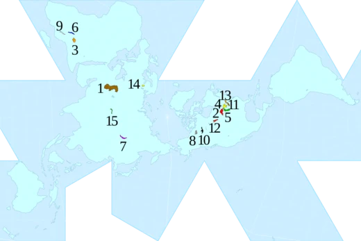
Lake Turkana is a saline lake in the Kenyan Rift Valley, predominantly in northern Kenya; the far northern end crosses into Ethiopia. It is the world's largest permanent desert lake and the world's largest alkaline lake. By volume it is the world's fourth-largest salt lake after the Caspian Sea, Issyk-Kul, and Lake Van (passing the shrinking South Aral Sea), and among all lakes it ranks 22nd. Lake Turkana is now threatened by the construction of the Gilgel Gibe III Dam in Ethiopia due to the damming of the Omo River which supplies most of the lake's water.
- type
- Saline lake
- location
- Kenyan Rift Valley, predominantly in northern Kenya; the far northern end crosse
- area_rank
- World's largest permanent desert lake; world's largest alkaline lake; fourth-lar
- volume_rank
- 22nd among all lakes
- primary_inflow
- Omo, Turkwel and Kerio rivers
- outflow
- None (only evaporation)
- water_temp
- 27–31 °C (81–88 °F)
Verified Timeline
Lore & Background
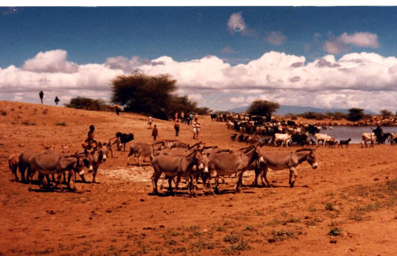
After the independence of Kenya, President Mzee Jomo Kenyatta renamed it in 1975 after the Turkana, the predominant tribe there. The Turkana refer to the lake as Anam Ka'alakol, meaning 'the sea of many fish'. It is from the name Ka'alakol that Kalokol, a town on the western shore of Lake Turkana, east of Lodwar, derives its name. The previous indigenous Turkana name for Lake Turkana was Anam a Cheper. The lake was originally named Lake Rudolf (in honour of Crown Prince Rudolf of Austria) by Count Sámuel Teleki de Szék and his second-in-command Lieutenant Ludwig Ritter Von Höhnel, a Hungarian and an Austrian, on 6 March 1888. They were the first Europeans to have recorded visiting the lake after a long safari across East Africa. At some unknown time, the lake acquired an alternative name as the Jade Sea from its turquoise colour seen approaching from a distance. The colour comes from algae that rise to the surface in calm weather. J. W. Gregory reported in The Geographical Journal of 1894 that it was called 'Basso Narok', meaning 'Black Lake' in the Samburu language.
Reader's Guide
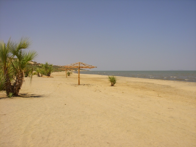
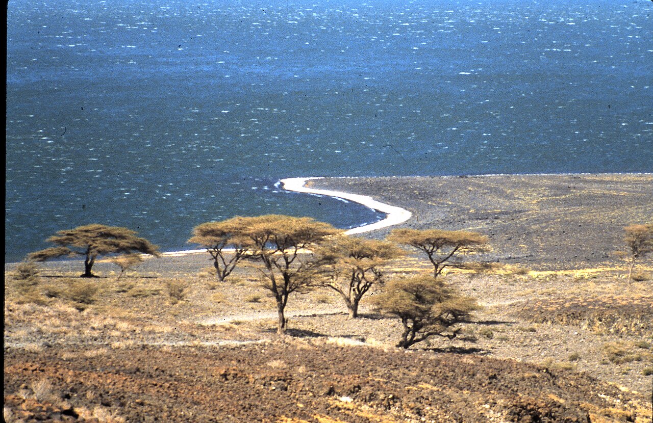
The lake's water is 27–31 °C (81–88 °F), and the mean air temperature of the region is similar or slightly higher. The climate is hot and very dry. On-shore and off-shore winds can be extremely strong, as the lake warms and cools more slowly than the land. Sudden, violent storms are frequent. Three rivers (the Omo, Turkwel and Kerio) flow into the lake, but lacking outflow, its only water loss is by evaporation. Lake volume and dimensions vary; for example, the level fell by 10 metres (33 ft) between 1975 and 1993. Although the lake commonly has been—and to some degree still is—used for drinking water, its salinity (slightly brackish) and very high levels of fluoride (much higher than in fluoridated water) generally make it unsuitable for drinking; it has also been a source of diseases spread by contaminated water. Increasingly, communities around the lake rely on underground springs for drinking water. The lake is rich in fish and fishing is very important to the local economy, but is threatened by falling water levels and overfishing. Nile crocodiles are found in great abundance on the shore flats. The rocky shores are home to scorpions and carpet vipers. Lake Turkana National Parks are now listed as a UNESCO World Heritage Site. Sibiloi National Park lies on the lake's eastern shore, while Central Island National Park and South Island National Park lie in the lake. Both are known for their Nile crocodiles. An abundance of hominid fossils have been discovered in the area surrounding Lake Turkana. The area sees few visitors, being a two day drive from Nairobi. The lake is also an imaginary boundary of the Rendille and Borana and Oromo to the Turkana land. The area is primarily clay-based and is more alkaline than seawater. Despite the lack of outflow, in ecology it is often regarded as a part of—or at least associated with—the Nile basin because of its prehistoric connection to this system and the similarities in their aquatic faunas.
Did You Know?
- The lake's level fell by 10 metres (33 ft) between 1975 and 1993.
- The Turkana call the lake Anam Ka'alakol, meaning 'the sea of many fish'.
- The lake was originally named Lake Rudolf by Count Sámuel Teleki de Szék and Lieutenant Ludwig Ritter Von Höhnel on 6 March 1888.
- The lake contains Africa's largest population of Nile crocodiles, estimated at 14,000 in a 1968 study by Alistair Graham.
- The lake's water is 27–31 °C (81–88 °F), and the mean air temperature of the region is similar or slightly higher.
Geography & Physical Character
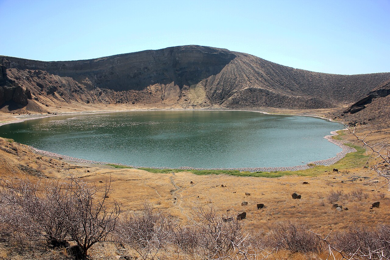
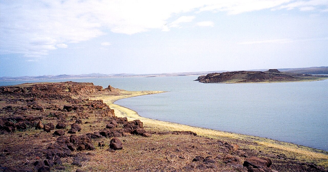
Nestled in the northern reaches of Kenya's Rift Valley, with its far northern tip crossing into Ethiopia, Lake Turkana holds the distinction of being both the world's largest permanent desert lake and its largest alkaline body of water. By volume it ranks fourth among salt lakes—trailing only the Caspian Sea, Issyk-Kul, and Lake Van—and sits at twenty-second place across all lakes. The surrounding geology is overwhelmingly volcanic; Central Island, an active volcano, still releases vapour into the air. Eastern and southern shores are defined by rocky outcrops, while western and northern margins drop into lower-elevation dunes, spits, and flats. The climate is intensely hot and arid, with lake water hovering between 27 and 31 degrees Celsius and regional air temperatures matching or exceeding that range. Three rivers—the Omo, Turkwel, and Kerio—feed the lake, yet no outflow exists; water leaves only through evaporation. This closed system means volume and dimensions shift over time, as illustrated by a ten-metre drop in level between 1975 and 1993. The surface is more alkaline than seawater, the terrain is predominantly clay-based, and the contrast between slowly warming water and rapidly heating land generates powerful on-shore and off-shore winds, with sudden violent storms a regular occurrence.
Ecology & Wildlife
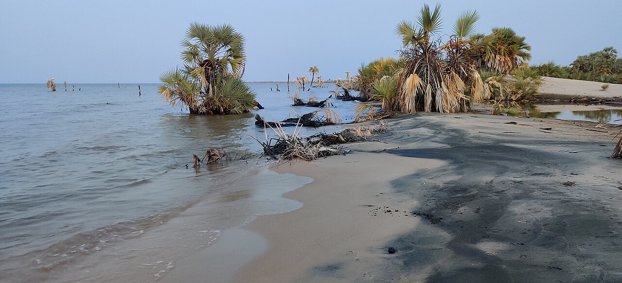
Because of the lake's warm temperatures, extreme aridity, and geographic inaccessibility, Lake Turkana retains a wild character that few other large African water bodies can claim. The surrounding landscape is classified as desert and xeric shrubland, with the Chalbi Desert lying to the east. In moister seasons a dry grassland of Aristida adscensionis and A. mutabilis appears, but in drier periods the grass vanishes entirely. Shrublands host dwarf species such as Duosperma eremophilum and Indigofera spinosa, while doum palms cluster near the water's edge. The aquatic community, though simpler than that of other major African lakes, supports roughly fifty fish species, twelve of which are endemics—including cichlids like Haplochromis macconneli and H. rudolfianus, the barb Enteromius turkanae, the catfish Chrysichthys turkana, and the Rudolf lates Lates longispinis. Non-endemic residents include Nile tilapia, bichirs, the elephantfish, African arowana, and Nile perch. Plankton communities span cyanobacteria, microalgae, copepods, cladocerans, and protozoans. On the rocky shores, scorpions and carpet vipers make their homes, while Nile crocodiles gather in great abundance along the shore flats.
Naming & Human Presence
The lake's name has shifted dramatically across centuries. In March 1888, Count Sámuel Teleki de Szék and his second-in-command Lieutenant Ludwig Ritter Von Höhnel became the first Europeans to record visiting the water after a long safari across East Africa, naming it Lake Rudolf in honour of Austria's Crown Prince. That European name persisted through the British colonial period. At some unknown point it also acquired the moniker Jade Sea, a likely European reference to the turquoise hue produced when algae rise to the surface in calm weather. The Samburu, among the dominant tribes when explorers arrived, reportedly called it Basso Narok, meaning Black Lake, as J. W. Gregory noted in 1894. After Kenya's independence, President Jomo Kenyatta renamed it in 1975 after the Turkana, the predominant local tribe. The Turkana themselves call it Anam Ka'alakol, the sea of many fish, a name that gave rise to the town of Kalokol on the western shore. Surrounding communities include the Rendille, Gabbra, Daasanach, Hamar Koke, Karo, Nyagatom, Mursi, Surma, and Molo peoples, and the lake serves as an imaginary boundary between Turkana land and Rendille and Borana-Oromo territory. Few visitors reach the area, which sits a two-day drive from Nairobi.
Threats & Preservation
Despite its UNESCO World Heritage designation, Lake Turkana faces mounting pressures from both human activity and environmental change. The construction of the Gilgel Gibe III Dam in Ethiopia, which dams the Omo River—the source of most of the lake's inflow—poses a direct threat to the water body's volume and stability. Fishing, a cornerstone of the local economy, is simultaneously squeezed by falling water levels and overfishing. The lake's water, while slightly brackish, carries fluoride levels far exceeding those in treated municipal supplies, and has historically been a vector for waterborne disease; communities are increasingly turning to underground springs for safe drinking water. The same salinity and alkalinity that render the water unsuitable for drinking also limit its utility for irrigation. Preservation efforts are anchored in three protected areas: Sibiloi National Park on the eastern shore, and Central Island and South Island National Parks within the lake, the latter two renowned for their Nile crocodile populations. The region's deep palaeontological significance, evidenced by an abundance of hominid fossils found in the surrounding terrain, further underscores the need to safeguard this extraordinary and increasingly vulnerable landscape.
Gallery
Frequently Asked Questions
What is Lake Turkana?
It is a saline lake sitting in the Kenyan Rift Valley, mostly within northern Kenya but with its far northern tip crossing into Ethiopia. It holds two world records: the largest permanent desert lake and the largest alkaline lake on the planet.
Where does Lake Turkana rank in size?
By volume it is the fourth-largest salt lake on Earth, trailing only the Caspian Sea, Issyk-Kul, and Lake Van. Counting all lakes globally, it lands at 22nd in total volume.
How does water get in and out of Lake Turkana?
Three rivers—Omo, Turkwel, and Kerio—feed the lake, but there is no river outflow at all. Every drop that enters eventually leaves as evaporation, which is exactly why the water is so salty.
Why is Lake Turkana important?
It is the world's largest permanent desert lake and its largest alkaline lake, making it a unique hydrological system in the Rift Valley. Its ecosystems and the surrounding communities depend entirely on the balance between river inflow and evaporation.
What threatens Lake Turkana?
The Gilgel Gibe III Dam in Ethiopia is damming the Omo River, the lake's biggest single water source. This has raised serious alarm that the lake could shrink dramatically over time.
More in Lakes Of The World 1-18
Spotted an error? Know more?
This is a living reference — every entry is fact-audited, and reader corrections feed straight into our audit queue. Suggest an edit · See this site's audit record