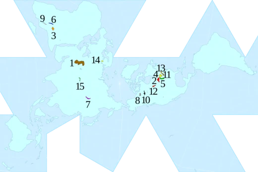
Lake Superior
Largest freshwater lake by surface area in the world.

Phizzy ( talk ) · CC BY-SA 3.0
Lake Superior is a lake in central North America. The northernmost, westernmost, and highest of the Great Lakes, Lake Superior straddles the Canada–United States border with the Canadian province of Ontario to the north and east and the U.S. states of Minnesota to the west and Michigan and Wisconsin to the south. It is the largest freshwater lake in the world by surface area and the third-largest freshwater lake by volume. It drains into Lake Huron via St. Marys River, then through the lower Great Lakes to the St. Lawrence River and ultimately the Atlantic Ocean.
- surface_area
- 31,700 square miles (82,000 km²)
- maximum_depth
- 1,333.0 feet (406.30 m)
- average_depth
- 483 feet (147.2 m)
- volume
- 2,900 cubic miles (12,100 km³)
- shoreline_length
- 2,726 miles (4,387 km)
- retention_time
- 191 years
- average_elevation
- 600 feet (183 m) above sea level
Verified Timeline
Lore & Background
The Ojibwe name for the lake is gichi-gami, meaning 'great sea.' Henry Wadsworth Longfellow wrote this name as 'Gitche Gumee' in the poem The Song of Hiawatha, as did Gordon Lightfoot in his song 'The Wreck of the Edmund Fitzgerald.' According to other sources, the full Ojibwe name is Ojibwe Gichigami or Anishinaabe Gichigami. In the 17th century, the first French explorers referred to their discovery as le lac supérieur. Some 17th-century Jesuit missionaries referred to it as Lac Tracy. After taking control of the region from the French in the 1760s, the British anglicized the lake's name to Superior, 'on account of its being superior in magnitude to any of the lakes on that vast continent.'
Lake Superior empties into Lake Huron via the St. Marys River and the Soo Locks. Its surface area is 31,700 square miles, approximately the size of South Carolina or Austria. It has a maximum length of 350 statute miles and maximum breadth of 160 statute miles. Its average depth is 80.5 fathoms (483 ft) with a maximum depth of 222.17 fathoms (1,333.0 ft). Lake Superior contains 2,900 cubic miles of water—enough to cover the entire land mass of North and South America to a depth of 30 centimetres. American limnologist J. Val Klump was the first person to reach the lowest depth of Lake Superior on July 30, 1985. The temperature below 110 fathoms (660 ft) is an almost constant 39 °F, and the lake is dimictic, mixing thoroughly twice per year. Annual storms regularly feature wave heights over 20 feet, with waves well over 30 feet recorded.
Reader's Guide
Lake Superior is the largest freshwater lake in the world by surface area and the third-largest by volume, behind Lake Baikal and Lake Tanganyika. Its name reflects Ojibwe heritage—gichi-gami meaning 'great sea'—and European exploration, with French explorers calling it le lac supérieur and the British anglicizing it to Superior. The lake is fed by more than 200 rivers, including the Nipigon River, the St. Louis River, the Pigeon River, the Pic River, the White River, the Michipicoten River, the Bois Brule River, and the Kaministiquia River. Its outlet at St. Marys River has a relatively steep gradient with rapids; the Soo Locks enable ships to bypass the rapids and overcome the 25-foot height difference between Lakes Superior and Huron. Water levels are regulated by the International Lake Superior Board of Control, established in 1914. The lake's average surface elevation is 600 feet above sea level. The largest island is Isle Royale in Michigan. Larger cities include Duluth, Minnesota; Superior, Wisconsin; Thunder Bay, Ontario; Marquette, Michigan; and Sault Ste. Marie, Michigan and Ontario. Duluth-Superior is the most inland point on the Saint Lawrence Seaway and the most inland port in the world. Scenic places include Apostle Islands National Lakeshore, Isle Royale National Park, Porcupine Mountains Wilderness State Park, Pukaskwa National Park, Lake Superior Provincial Park, Grand Island National Recreation Area, Sleeping Giant (Ontario), and Pictured Rocks National Lakeshore.
Did You Know?
- Lake Superior contains enough water to cover the entire land mass of North and South America to a depth of 30 centimetres.
- American limnologist J. Val Klump was the first person to reach the lowest depth of Lake Superior on July 30, 1985.
- The lake's retention time is 191 years.
- Annual storms on Lake Superior regularly feature wave heights over 20 feet, with waves well over 30 feet recorded.
- The Ojibwe name gichi-gami means 'great sea,' and was written as 'Gitche Gumee' by Henry Wadsworth Longfellow and Gordon Lightfoot.
Naming & Cultural Heritage
The lake's identity carries layers of linguistic and political history stretching back centuries. Indigenous Ojibwe speakers have long called it gichi-gami, a term meaning "great sea," a name that resonates with the water's vast, oceanic presence. The full designation in some dialects includes a possessive element—Ojibwe Gichigami or Anishinaabe Gichigami—emphasizing the lake as belonging to the people. Father Frederic Baraga captured this in his 1853 Ojibwe dictionary as Otchipwe-kitchi-gami. In the literary world, Henry Wadsworth Longfellow rendered the name as "Gitche Gumee" in The Song of Hiawatha, and decades later Gordon Lightfoot echoed it in his ballad about the Edmund Fitzgerald. European contact brought new labels: 17th-century French explorers arriving via the Ottawa River and Lake Huron called it le lac supérieur, simply the "upper lake" relative to Huron's elevation. Jesuit missionaries of the same era used Lac Tracy, honoring Alexandre de Prouville de Tracy. After Britain seized the territory from France in the 1760s following the French and Indian War, the name was anglicized to Superior, a choice justified by the lake's unmatched magnitude among the continent's inland waters.
Physical Scale & Hydrography
Few bodies of freshwater on Earth rival the sheer dimensions of this northern expanse. Spanning 31,700 square miles—roughly the footprint of South Carolina or Austria—it holds the title of the world's largest freshwater lake by surface area. Its maximum length stretches 350 statute miles, while its broadest point measures 160 miles across. Beneath that vast surface, the average depth reaches 483 feet, and the deepest point plunges to 1,333 feet. The total water volume of 2,900 cubic miles is so immense that, spread evenly, it could blanket the combined landmasses of North and South America to a depth of twelve inches. Only Lake Baikal in Siberia and Lake Tanganyika in East Africa surpass it in volume among freshwater lakes. The shoreline, including all islands, extends 2,726 miles. A striking hydrographic feature is the lake's exceptionally small catchment-to-surface ratio of 1.55, signaling that terrestrial runoff contributes relatively little to its water budget. The retention time—the average duration a water molecule lingers in the lake before exiting—stands at 191 years, a testament to its enormous storage capacity.
Water Level Management & Record Extremes
For much of its history, the lake's outflow was governed entirely by the natural gradient of the St. Marys River rapids. That changed by 1921, when gates, locks, power canals, and other engineering works came to span the rapids completely, serving both commercial shipping and hydroelectric generation. The resulting regulating structure, called the Compensating Works, operates under a framework known as Plan 1977-A. Day-to-day oversight falls to the International Lake Superior Board of Control, established in 1914 by the International Joint Commission, which also manages diversions from the Hudson Bay watershed. The lake's surface sits at an average elevation of 600 feet above sea level, and its level follows a predictable seasonal rhythm: peaks typically arrive in October and November, while troughs occur in March and April. The highest recorded level came in the summer of 1985, reaching 2.33 feet above the established datum. The lowest recorded level struck in the winter of 1926, dropping 1.58 feet below datum, with the entire first half of that year posting record-low months. September 2007 briefly set a new all-time low before recovering within days, and the years 2019 and 2020 shattered high-water records in nearly every month.
Seasonal Ecology & Storm Character
Beneath its deceptively calm surface, the lake operates on a rigorous thermal calendar. Surface temperatures shift with the seasons, but below roughly 200 feet the water holds a near-constant 39 degrees Fahrenheit year-round. Twice annually, the entire water column equalizes to that same 39-degree temperature, triggering a thorough top-to-bottom mixing event that classifies the lake as dimictic. This seasonal turnover ensures the waters mix completely from surface to depth. The lake is fed by more than 200 rivers, including the Nipigon, St. Louis, Pigeon, Pic, White, Michipicoten, Bois Brule, and Kaministiquia, each contributing to its enormous volume. At the outlet, the St. Marys River presents a steep gradient with rapids, a 25-foot elevation drop that ships must navigate through the Soo Locks to pass into Lake Huron. On the surface, the lake's storm character is formidable. Annual weather systems regularly generate waves exceeding 20 feet, and swell heights well past 30 feet have been documented. In July 1985, limnologist J. Val Klump became the first person to reach the lake's deepest point, a spot sitting 733 feet below sea level—the second-lowest interior elevation in the contiguous United States.
Gallery
Frequently Asked Questions
Who is Lake Superior?
Lake Superior is the northernmost, westernmost, and highest of North America's five Great Lakes, sitting along the Canada–United States border. Its shores are shared by Ontario to the north and east, and Minnesota, Michigan, and Wisconsin to the south and west.
What is Lake Superior's claim to fame?
It holds the record as the world's largest freshwater lake by surface area, spanning roughly 31,700 square miles. By volume it ranks third among all freshwater lakes, storing about 2,900 cubic miles of water.
How big is Lake Superior's shoreline?
The total shoreline stretches approximately 2,726 miles (4,387 km) around its perimeter. The lake's maximum depth reaches 1,333 feet (406 m), with an average depth of about 483 feet.
What role does Lake Superior play in the Great Lakes waterway?
It acts as the upstream starting point of the Great Lakes chain, releasing water southward through the St. Marys River into Lake Huron. From Huron the flow continues eastward until it eventually reaches the Atlantic Ocean.
How long does water stay in Lake Superior before it leaves?
The lake's retention time is roughly 191 years, meaning the average water molecule takes nearly two centuries to cycle through the entire basin. This slow turnover is a direct result of its enormous volume relative to the single outflow via the St. Marys River.
More in Lakes Of The World 1-18
Spotted an error? Know more?
This is a living reference — every entry is fact-audited, and reader corrections feed straight into our audit queue. Suggest an edit · See this site's audit record